

Featured hiking trails in St Barth

While St. Barts is known for its luxurious beaches and upscale lifestyle, the island also offers unforgettable hiking experiences. From coastal cliffs to peaceful nature trails, hiking in St. Barts reveals a wilder, more serene side of this Caribbean gem. Whether you’re a beginner, family traveler, photographer, or thrill-seeker, this guide covers the best hikes for every kind of adventurer.
Featured hiking trails in St Barts
A table of hiking trails in St Barts
| Trail Name | Highlights | Thumbnail |
|---|---|---|
| Colombier Beach Trail |  | |
| Grand Fond to Saline Trail |
|  |
| Gouverneur to Saline Trail |
|  |
| Morne Lurin Trail |
| |
| Toiny Coast Trail |
|  |
| Fort Karl Trail |
|  |
| Morne du Vitet Trail |
| |
| Pointe Milou Trail |
|  |
| Guanahani Peninsula Walk |
|  |
For more detailed information on these trails, you can visit the Gustavia Harbor hiking guide.
Hiking in St. Barts: Trails, Tips & What to Expect for Every Kind of Explorer
🌦️ Weather: When Is the Best Time to Hike in St. Barts?
- Best Time to Hike: November to April (dry season)
- Temperature: 75°F to 85°F (24°C to 29°C)
- Rainy Season: May to October – trails may become slippery
Pro Tip: Start hikes early in the day and bring plenty of water, sunscreen, and a hat.
👶 Best Trails for Beginners & Families
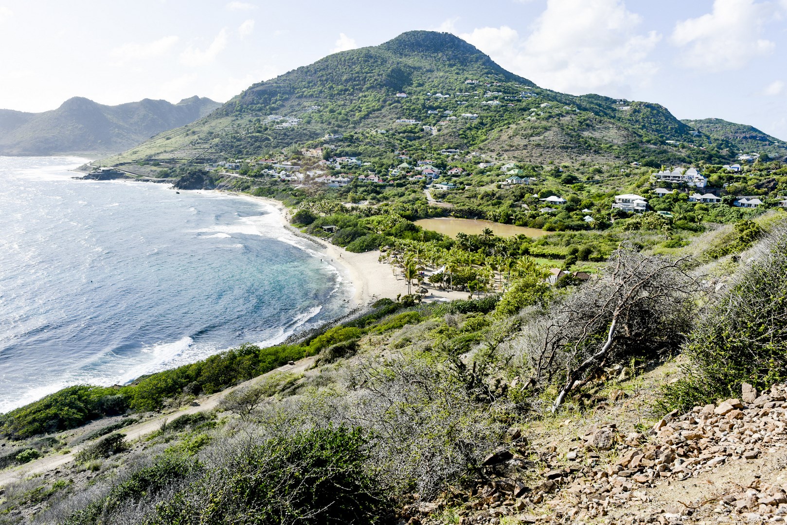
📍 Colombier Beach Trail
- Difficulty: Easy to moderate
- Distance: ~1.2 miles roundtrip (2 km)
- Highlights: Secluded beach, scenic ocean views, shaded path
- Family-Friendly: Yes – gentle terrain, great beach reward
📍 Grand Fond to Natural Pools
- Difficulty: Easy
- Distance: ~0.8 miles roundtrip (1.3 km)
- Highlights: Tide pools, rocky coastline, good for kids with supervision
Safety Tip: Avoid during high tide or rough surf.
⛰️ For Experienced Hikers
📍 Morne de Vitet
- Difficulty: Moderate to challenging
- Elevation: 286 meters (938 feet)
- Highlights: Panoramic views, wild vegetation, fewer tourists
📍 Toiny Coastline Trail
- Difficulty: Moderate
- Distance: ~3 miles roundtrip (4.8 km)
- Highlights: Windy cliffs, dramatic waves, goats, wildflowers
Note: No shade – wear a hat and bring extra water.
📸 Best Trails for Photographers
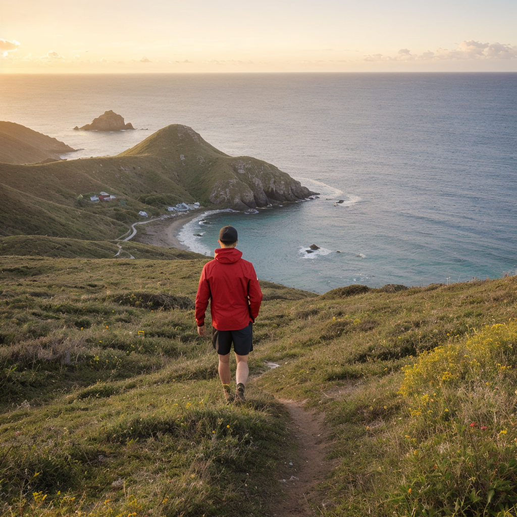
📍 Colombier Overlook at Sunset
Capture golden light, calm seas, and anchored sailboats from above the beach. One of the best sunset spots in St. Barts.
📍 Petit Cul-de-Sac Mangroves
Photograph flamingos, marine life, and mirror-like reflections in this quiet, photogenic location.
📍 Toiny to Grand Fond (Sunrise Trail)
Get early-morning light, long shadows, and moody textures on this wild stretch of coast.
🧘 For Wellness Seekers
📍 Lorient to Pointe Milou
- Distance: ~2 miles roundtrip (3.2 km)
- Vibe: Peaceful, meditative, ocean breeze and minimal traffic
📍 Saline Salt Flats
Quiet, flat terrain with opportunities for mindfulness, flamingo spotting, and wide-open skies for grounding and reflection.
🐾 For Pet Owners
📍 Grand Cul-de-Sac Lagoon Trail
- Dog-Friendly: Yes
- Distance: Short and safe
- Features: Calm water access, shade, gentle walking surface
📍 Corossol Hillside Path
Shaded, low-traffic, and great for a casual hike with your pup. Bring a leash and waste bags.
🧗 For Adventure Seekers
📍 Off-Trail Toiny Cliffs
- Challenge: Unmarked paths, volcanic rock, high exposure
- Recommended: Trail shoes, GPS, gloves
📍 Hidden Caves Near Grand Fond
Explore lava rock caves and blowholes. Best done with a guide and only at low tide.
📍 Full Island Traverse
- Route: Toiny → Morne Rouge → Flamands
- Distance: ~6–8 miles
- Why It’s Epic: Diverse ecosystems, ultimate cardio, sweeping vistas
✅ Quick Hiking Tips
- Wear supportive shoes
- Start early to avoid heat
- Pack out all trash
- Use GPS apps like Maps.me
- Check tide charts for coastal hikes
🏞️ Quick Guide by Hiker Type
| Traveler Type | Best Trail |
|---|---|
| Beginners & Families | Colombier Beach Trail |
| Experienced Hikers | Morne de Vitet or Toiny Coastline |
| Photographers | Toiny Sunrise Trail, Colombier Overlook |
| Wellness Seekers | Lorient to Pointe Milou, Saline Salt Flats |
| Pet Owners | Grand Cul-de-Sac Lagoon Trail |
| Adventure Seekers | Off-Trail Toiny Cliffs, Hidden Caves |
🌴 Final Thoughts
Hiking in St. Barts offers a soul-stirring experience beyond the beach. Whether you’re gazing at the sunrise on a coastal bluff, dipping into a hidden tide pool, or trekking to the island’s highest peak, each trail reveals something special. Bring water, go slow, and let nature work its magic.
These are just a few of the hiking trails you can explore in Gustavia Harbor. Make sure to bring plenty of water, sunscreen, and insect repellent, as well as a good pair of hiking shoes. And always remember to respect the local flora and fauna, as well as any signs and regulations in the area.